Saturday, February 2, 2008

The bridge at Broadway over the Los Angeles River - Jan 26th 2008

The storm continues down stream just before China Town as
Broadway crosses the Los Angeles River:

Downtown viewed from Broadway Bridge. Jan 26th 2008

Looking south from the Broadway bridge
there is plenty of good brown water flowing,
carrying the silt from the hills.

"It's Not a Cornfield" but now it's a State Park in the process of
development - as viewed from the Broadway Bridge looking toward China Town.

Labels: , , , , ,

Los Angeles River at Atwater Flowing Under Los Feliz Blvd

ATWATER and a "SOFT BOTTOM"

This was the view on Jan 26th, 2008 of the Los Angeles River as it
flows under Los Feliz Blvd. and runs parallel to the 5 Freeway at Atwater just east of Griffith Park and Riverside Drive.


These were all taken on Saturday, Jan 26th 2008Griffith Park is in the background and the Bikers Bridge
that crosses Los Feliz Blvd.


"Soft bottom" portion of the Los Angeles River starts here.

View just south of Los Feliz Blvd. shown above
standing at "Yoga Park" on the east side of the Los Angeles River
and looking south toward downtown.

Labels: , , , , ,

Big Tujunga Wash at Foothill Blvd - Sunland area

Big Tujunga Wash - a "braided river"


View looking up the braided river bed - North and East toward the San Gabriel Mountains.


Bridge crossing Foothill Blvd facing toward Sunland - is in the midst of
construction / destruction.


South side of the bridge has been torn up.


Graffiti under the bridge, where the face anticipates the destruction of this
beautiful bridge or something else.


Jan 26, 2008: Storm water runs off of the San Gabriel Mountains through the Big Tujunga Wash (shown here) to the Hansen Dam and then eventually to the Los Angeles River. This "wash" is a braided river on an alluvial fan. It is called a "wash" because it has very low water flow except in the rainy season November - March so it is not considered a "river" because of its lack of flow in the dry part of the year.

Labels: , , , , , ,

Los Angeles River / Pasadena Arroyo Seco: THE CONFLUENCE (where two rivers meet)

Location as seen from Google Earth in a dry time:


Some of my special river places were "water full" on Sunday the 27th of Jan. 2008
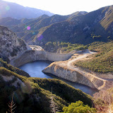
#1 The channelized Arroyo Seco "river" coming down from Pasadena.
(arroyo means creek or draw, seco means dry)
We see here its swollen water flow just before the
Arroyo Seco joins the Los Angeles River.
*******
*******

This is THE CONFLUENCE, where on August 2nd 1769
Captain Gaspar de Portola and Father Juan Crespi
along with a group of 63-67 men, entered what is now Los Angeles
through Elysian Park. It was the presence of water here that made
this a viable place for the Spanish King to establish a colony and
the nearby missions of San Fernando and San Gabriel.
*******
*******
The Los Angeles Fire Department's Swift Water Rescue Team
pulled a car out of the Arroyo Seco, up stream from this site earlier in the day
in Lincoln Heights/Solano Canyon. See picture # 3 for the officer
who led the rescue. Here is the link to the full story with photos:
http://lafd.blogspot.com/2008/01/two-rescued-when-car-plunges-off.html
Picture #1a
The Arroyo Seco flowing down from Pasadena and the San Gabriel Mountains joins with the Los Angeles River here on the other side of the bridge (two views: above and below)

Picture #1b.

The Los Angeles River just a few yards before the Arroyo Seco "river" joins it.


#2 Two views of the "access road" to the Los Angeles River just
before The Confluence with the Arroyo Seco "river" shown above.

Arroyo Seco Art

Graffiti Art that was painted in October 2007 when the Arroyo Seco was dry.
Now partially inundated with river water.


Picture # 3 The LAFD's Swift Water Rescue Team officer speaks to
Professor Jenny Price's USC river tour class.

Labels: , , , , , ,

Water Shed Slide Show - Jan 2007

Check out my web album of the Tujunga Watershed at:
Click on this image.
Big Tujunga Dam San Gabriel Mts Watershed

Friday, February 1, 2008

Tujunga Dam and Reservoir

Top Image - Tujunga Dam on Jan 27th 2008 - viewed from the east.

Bottom Image - Tujunga Dam circa 2005 - at capacity with water releasing.
View from the south west. I would love to find the place that this picture is taken from.
Could it be a helicopter ?

On Big Tujunga Canyon Road police blocked the road to casual drivers on Sunday ( Jan 27th) during the storm. Obsessed in pursuit of my hydrology project, I was able to convince the officer to give me an hour to take pictures up stream. There were only minor debris flows on the road and a good water volume in the Tujunga "river" aka Tujunga Wash, behind the Tujunga Dam and in the Reservoir. The dam is in the midst of a seismic retrofit that just started in 2007. So its master does not want it to fill fully: the County Water Master released water during the storm before it could fill more than 75 %. The top image and compares to the Dam at full capacity in an image from 2005 that I snagged from the Mountain Conservancy at: http://www.mrca.ca.gov/pdf/attachment930_Attachment%201.pdf

Labels: , , , , , ,